


Overview
On the eastern part of the City of Toronto lies one of its most famous river systems that has shaped the city since its founding. The Don River was once one of the most important transportation and freshwater sources for the city of Toronto.
In 1890, the River was straightened further towards the south to make it easier to navigate and travel up and down the river system (City of Toronto, 2018).
To make the city greener, the Don Valley has been left relatively intact despite the development that happened inside of it and around it.
As you travel along this trail, you will see the city’s efforts in an ongoing effort to renaturalize the effort- but be warned, this area is a lot more difficult to traverse than many of the other trails featured here.
Location
History
The Don Valley and River- especially the part found in southern Toronto was once known as Waasayishkodenayosh, or Wonscotonach- meaning the “burning bright point” in Anishnaabemowin (Don Valley River Park, 2019).
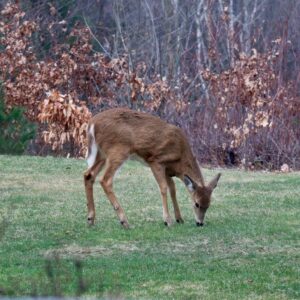
The area was used by Anishinaabe peoples like the Mississauga’s of the Credit to fish by torchlight. Back then the river/valley system was used as hunting grounds due to its high populations of deer and fish species.
When the City of York was founded by John Graves Simcoe, the original city was not so much lakefront as it was a riverfront city, straddling the Don Valley in its original configuration (City of Toronto, 2018).
However, this caused the river to industrialize and lose much of its ecological diversity.
It also caused the city to shift away from the Don Valley so that the smells and industry from the Don River did not have to be smelt at all times (UOFT, n.d.).
Further industrialization occurred in the Don Valley in the late 18th and 19th centuries where train tracks were laid, causing it to become a place that was hard to cross without the use of the bridges. (City of Toronto, 2018).
No longer was it accessible to cross via kayak or boat.
A further nail in the coffin was put into the Don Valley with the building of the Don Valley Parkway which further divided the Valley and river system (City of Toronto, 2013).
With all these factors that unnaturalized this area, the area became prone to flooding, however, the city began to identify a plan in 2008 which would lessen the effects of the flooding (Waterfront Toronto, n.d.).
Species On Trail
Featured Ecosystems
The Don Valley River System is one of the most integral river systems in the City of Toronto. It is practically the birthplace of what was the city of York and what is now the city of Toronto.
As such, the main ecosystem here is the wetlands, along with with river edge that allows for various types of birds and amphibians to call it home. (City of Toronto, 2018).
Further naturalization efforts are being made so that fish can call this waterway home again and luckily, this part of the Don Valley has been naturalized enough that fish populations have begun to return such as trout and perch populations (TRCA, 2016).
There is also a wooded area here that was once part of the Todmorden Mills acquire area, meaning that these trees were all once used to help make paper, pulp and forestry goods.
Thanks to efforts of the city and local advocacy groups, these forest areas of returned to their natural state (TRCA, 2016).
Citations
City of Toronto. (2013). Don Valley Masterplan. https://www.toronto.ca/wp-content/uploads/2018/01/8ecf-lower_don_trail_master_plan.pdf
The Don Valley River Park. (2019). Wonscotonach Parklands: What we’re hearing. https://donrivervalleypark.ca/news/wonscotonach-parklands-what-were-hearing/
TRCA. (2016). Environmental Study & Flood Report of the Don Valley. https://trca.ca/app/uploads/2016/02/Class-EA-Part-4-Section-4.pdf
Waterfront Toronto. (n.d.). Lower Don Lands. https://www.waterfrontoronto.ca/our-projects/lower-don-lands
